Wings Too Sore to Soar
Society makes me feel like a bird in a cage. Or so it seems. Being confined in this human body, there are limits. And if I were to feel free as a bird outside his cage, would I be able to spread my wings and fly.
My mom agreed she would accompany me out of town, possibly for a couple days. It’s my three day “birthday” weekend, and I wanted to hike a mountain. I chose Sunshine Peak, a Colorado 14er located in the San Juan mountain range.
We blasted towards Sunshine around 9pm, taking 285 South. The sky held a half-moon as the road began to become narrow through the mountainous silhouette. I would lose internet connection during the drive, thinking to myself, damn, I should have downloaded a playlist through my Spotify premium. As we were near Fairplay, it became an open road with the distant mountains surrounding the area where one side, the moon gleamed, and on the left side, deep in the darkness, lightning flashed.
We passed the Lake San Cristobal sign along Cinnamon Pass, shortly after the GPS had us parked in the shoulder lane of the rocky (County Road), CR30. It was 2:30am, and I had already driven 5 and a half hours. The light of the car could luminate for only so far, being pitch black as far as the eye can see. I opened the door and it was very chilly and damp, reminding me of the desired hoodie I should’ve brought. I used my neck lamp to see if there was a clear path—no luck. So we remained parked as my mom and I grabbed a little shut eye for a few hours.

Along Cinnamon Pass

Lake San Cristobal sign… during the day
It was 6:00am, and I continued west on CR30, through its rocky canyon road. It wasn’t for another 45 minutes until we actually reached the base and campground of Sunshine Peak.
The reality was my front thighs were sore and cramping up. If I were to hike, that’d been a long wait for my mom. It was already 6:45am and I—projected—wouldn’t be back in the car until 6:45pm if I were to hike Sunshine. In other words, maybe this bird’s wings were too sore to fly.

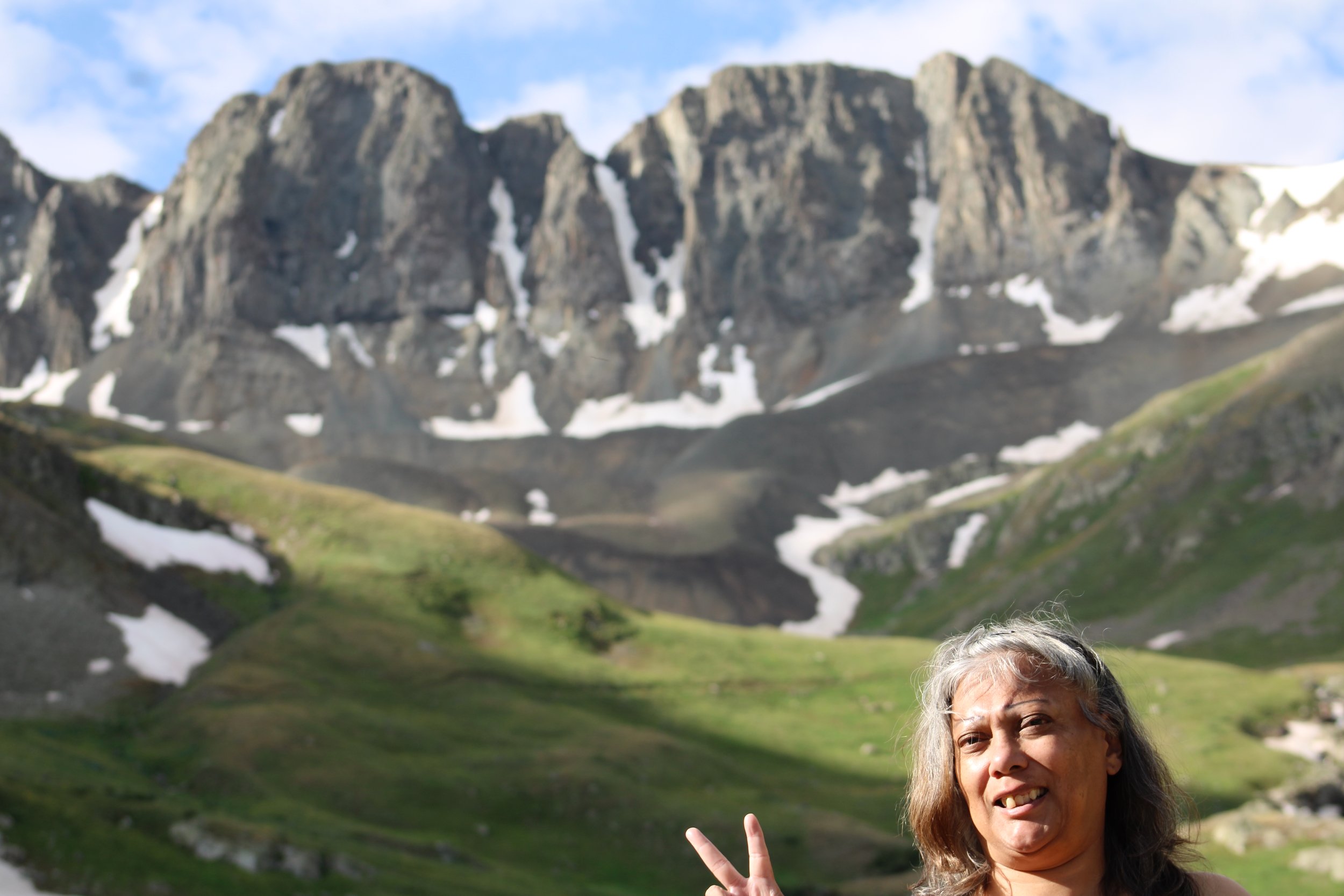
The base of Redcloud Peak & Sunshine Peak
We continued west through the bulges of rock. Note, if you ever plan to drive on CR30, make sure you drive a 4-wheeler—something like a Jeep. It was the end of the road, as we arrived near a bowl—a valley known as American Basin of the San Juan mountain range. It was surreal and had a Swiss look to it.